
The South Wall of the Precipice - Champlain Mountain, Acadia National Park
Page by: Arlo Cristofaro-Hark, Ite Sullivan, Peter Kennell

Mt Desert Island, Maine. Image: Google Maps
Mount Desert Island (MDI)
South Wall
Longitutde: 68°11'23.99"W
Latitude: 44°20'49.43"N
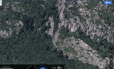
Animation of the South Wall. Images: Google Maps.
GIF: Ite Sullivan
Glaciation of MDI
20-30,000 years ago, MDI and the rest of North America was covered in massive sheets of ice. Over the course of thousands of years, these glaciers migrated–retreating when they melted and expanding when they froze. As these glaciers moved, they began grinding the sides of the existing hills and valleys, slowly scraping away the rock and dirt evenly from the top and sides of the landforms they passed over. This resulted in the U-Shaped Valleys of MDI that are oriented north-south. In the Northern Hemisphere, glaciers expand to the south and retreat to the north; the orientation of the valleys and hills of MDI today provides us with evidence of the direction that the glaciers travelled.

Glaciation and sea level rise at the South Wall. Images and elevation data: Google Earth Pro. Illustration: P. Kennell
Formation of the South Wall (Roche moutonnée)
As glaciers passed over the the the tops of the hills, the ice at the bottom of the glaciers was compressed. This compression resulted in higher temperature and ice melt underneath. After passing over the tip of the hills, more space allowed for less compression and therefore a quick drop in temperature. The sudden drop in temperature resulted in the refreezing of the ice melt to the rock surface, pulling large chunks of rock off the hills and leaving large cliffs in the wake. This effect is called “Roche Moutonnée.” Because the glaciers expanded south, we have more large open faces on the south sides of the mountains of the area. This effect can be seen at South Wall, along with various other south-facing cliffs of MDI.
Processes that lead to rockfalls
Fracture Orientations and Relationships to the South Wall and Glaciation
- Fractures occur when rock formations are subject to STRESS!
- Fractures are caused by stress, when a rock is subjected to stress in excess of its strength, it fractures along its weakest plane.
- This glaciations were very heavy and indented the crust, smooshing it the malleable mantle
- After the glaciers retreated to the north, the indented earth started to rebound
- Lots of stress on rocks because of this rebound
- Additionally, fractures may have formed because of ancient tectonic activity in the area
(Right) The South Wall and boulder field.
Photo: Ite Sullivan

Rock Climbing at South Wall
Along with its geological significance, South Wall is known in the world of rock climbing to be an excellent destination for those seeking a vertical thrill. The large open faces, crystalline textures and intricate fracture sets are characteristics of this area that lend themselves well to the sport.
While exploring the area, you might notice silver, permanent bolts anchored into the cliff sides. These are used by climbers for protection while “sport climbing”–a style in which the climber attaches a rope to their harness and trails it behind them as they climb, clipping into these permanent bolts with carabiners as they go. “Traditional climbing” is similar to sport climbing, but instead of clipping into permanent bolts for protection, climbers place non-permanent gear into the fractures that can be removed after they have finished the route.
(Left) A climbing route follows fractures.
Photo: P. Kennell

Fractures in the South Wall granite provide excellent hand and foot holds for climbers! As you will see upon visiting the area, there are plenty of fractures, with 60+ routes that climbers regularly ascend. People have been rock climbing on MDI since the 1960s, but with increased popularity in the 1980s. If you are interested in rock climbing, contact Acadia Mountain Guides for more information about climbing in the area, or to set up a day of guided climbing in Acadia. To see a list of routes at South Wall along with some pictures of the area, visit the Mountain Project.
(Left) Fractures in the South Wall.
Photo: Ite Sullivan


South wall trailhead and climbing areas. Images: Google Earth Pro. Illustration: P. Kennell
References:
Braun, Duane D., and Ruth Braun. Guide to the Geology of Mount Desert Island and Acadia National Park. Berkeley, CA: North Atlantic, 2016. Print.
Hall, Sarah. Personal communication, fall 2016.